A port built where the river met the sea
Old Banten, or Banten Lama, is often approached today as an archaeological and religious site north of Serang. Its more revealing identity is that of a port city. The settlement stood in the delta of the Cibanten River, where waterways, markets, a royal compound and an anchorage formed the working geography of the Sultanate of Banten.
The harbour’s physical advantages also explain its later vulnerability. The Cibanten divided into branches around the city, while water transport was an important way to move inside the settlement. Karangantu, at the eastern mouth, hosted a major market and foreign Muslim communities. At the western mouth, Pabean was associated with customs collection and Pamerican with the storage of pepper, one of the commodities that made Banten prosperous.
How the sultanate turned a coastal town into a commercial hub
The chronology is preserved in the Sajarah Banten and tested against archaeology and early European descriptions. In the early 16th century, political and commercial power moved downstream from Banten Girang to the coast. The NUS archaeological account says Maulana Hasanuddin was credited with creating a great port at Banten Lama, together with a palace and a Great Mosque, during his reign to 1570. His successor, Maulana Yusuf, is associated with forts, dams, canals and the expansion of rice cultivation and settlement.
Banten’s rise accelerated after the Portuguese conquest of Melaka in 1511. The movement of Muslim merchants away from Melaka helped make Banten a new centre of Southeast Asian trade. By the time Dutch and British fleets reached the bay in 1596, the NUS report records 70 vessels at anchor. That figure comes from an early travel account and should be read as a snapshot, not a permanent measure of the harbour’s size.
The port was not a single-commodity outpost. Pepper was central, but archaeological and archival evidence also points to ceramics and other goods moving through the city. Chinese wares were used locally and re-exported to other parts of Indonesia, India and Europe. The NUS study records Dutch ships carrying about 500,000 ceramics from Banten to the Netherlands between 1610 and 1624, while noting that Banten’s own ships sometimes carried Chinese ceramics to Surat in northwestern India.
Routes, quarters and a cosmopolitan market
Old Banten’s maritime network reached beyond a simple Java–Europe axis. Merchants from Java, Sumatra, Borneo, Sumbawa, Makassar, Banda and Ambon lived in the port. The historical account also names traders from Pegu, South India, Gujarat, Bengal, Burma, Thailand, Arabia and Persia, as well as a community described in the source as Abyssinian. Separate kampongs, or quarters, were associated with different communities, occupations and royal functions.
Karangantu was described as the largest of Banten’s markets. Pacinan had another market and a Chinese quarter, while a market also operated within the city wall. This arrangement helps explain why the sultanate’s capital was more than a royal court: it was a regulated exchange where harbour officials, moneylenders, ship captains, local producers and overseas merchants met.
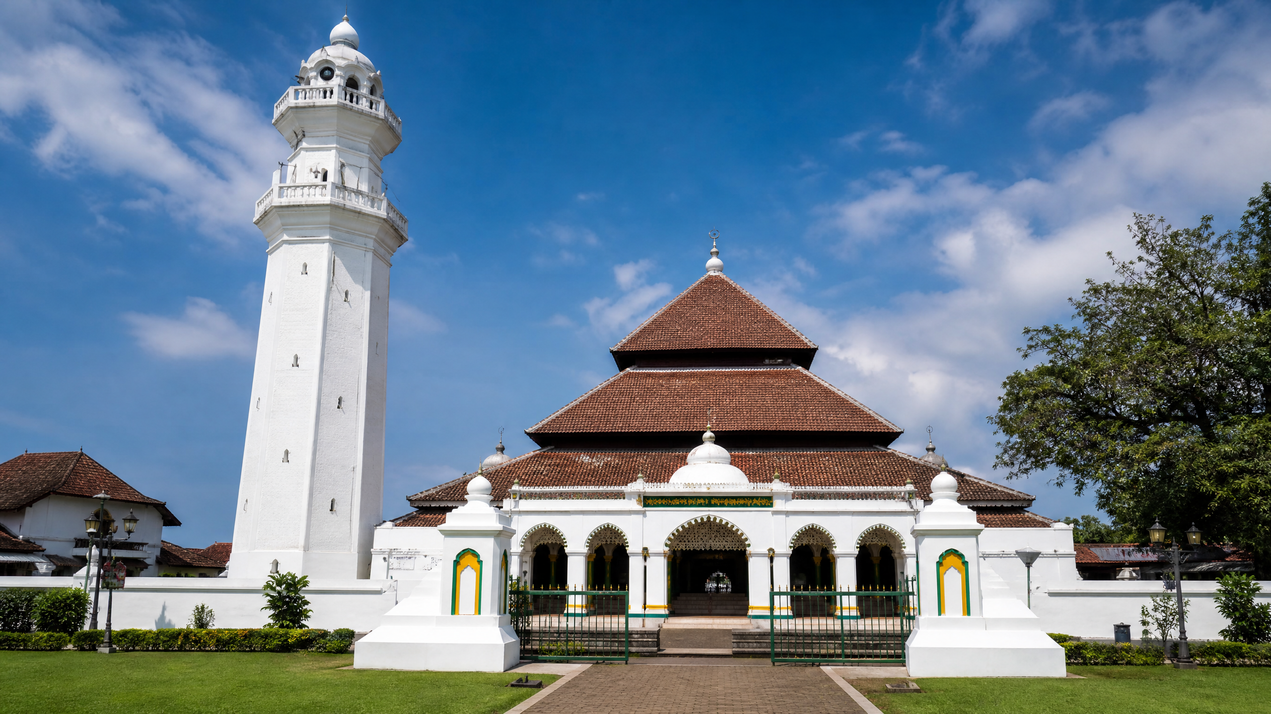
The city’s religious architecture also had a practical maritime role. The NUS study says the Great Mosque’s tall Indo-Islamic minaret could be seen from far out at sea, functioning as a landmark for vessels approaching the anchorage as well as a public statement of Islam. In a port dependent on visibility and orientation, the minaret was part of the navigational landscape.
What survives after the harbour silted up
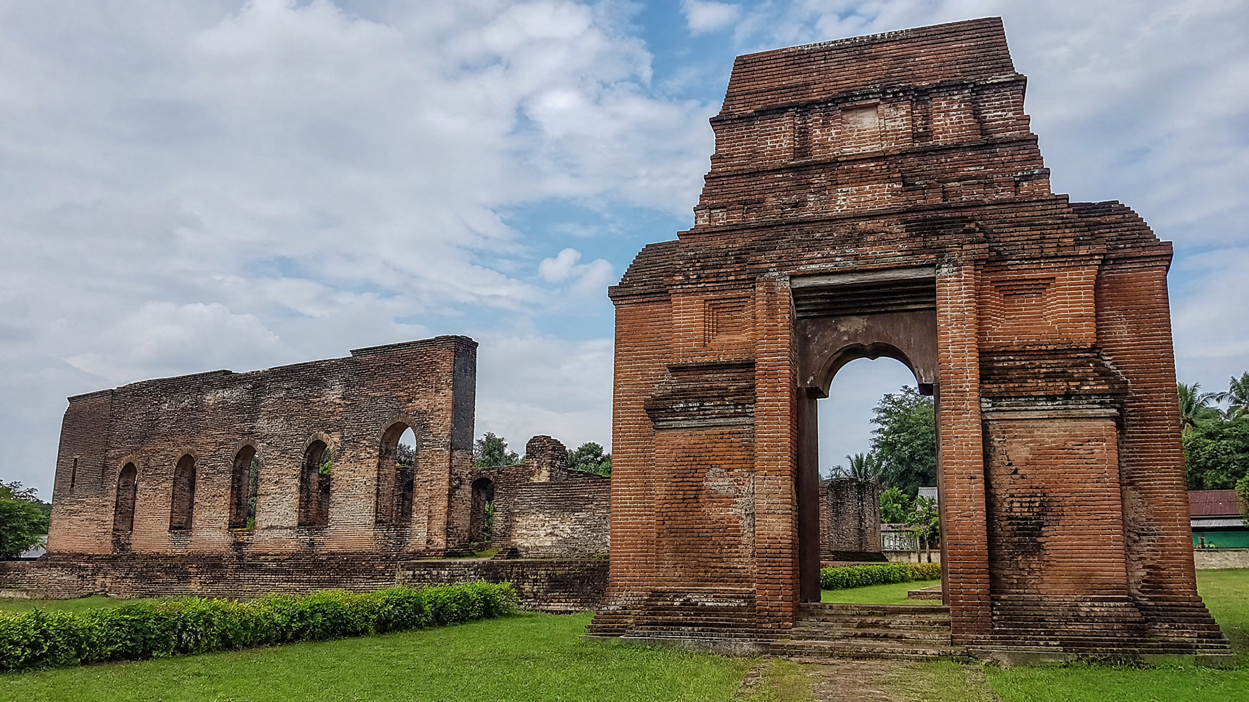
Today, the most substantial reminder of the sultanate’s centre is the Great Mosque of Banten, generally dated to the 1550s. The mosque remains in use and is closely associated with the tomb complex of Banten’s rulers. Nearby, the broken walls and foundations of Surosowan Palace indicate the scale of the royal compound, even though the palace was later destroyed.
Kaibon Palace stands near the point where the Cibanten’s branches divide. Fort Speelwijk, built by the Dutch at the western mouth of the river in the 1680s, shows how control of the waterway became a colonial military concern. The fort is now far inland relative to the former shoreline. The NUS report links that change to the silting of the port; Britannica likewise describes the harbour as having silted up by the end of the 18th century and places the former port site more than 1.6 kilometres from the sea.
Other remains, including Masjid Pacinan and the wider archaeological deposits, preserve evidence of the city’s diverse communities. The provincial government’s January 2025 account of a ministerial visit lists Fort Speelwijk, Kaibon, Surosowan, the Great Mosque and the Banten Lama Archaeological Museum, and says the museum’s revitalisation was inaugurated during that visit.
What we know
-
Well established: Old Banten was a major early-modern port, with Karangantu markets, river-based transport, pepper storage and extensive overseas merchant connections.
-
Still visible: The Great Mosque, Surosowan and Kaibon ruins, Fort Speelwijk, Pacinan-related remains and the archaeological museum allow visitors to read the former city’s religious, royal, commercial and defensive layers.
-
Important limitation: Publicly available official updates reviewed for this article document the museum revitalisation in January 2025 and earlier provincial site-planning phases, but do not establish a new 2026 construction milestone specifically at Old Banten. In February 2026, Antara reported that the Culture Ministry had revitalised 152 heritage sites and museums nationwide; that report did not identify Old Banten among the named examples.
The surviving landmarks therefore do not present a complete city. They present fragments of a maritime system: a mosque that could guide ships, a palace that organised authority, markets that connected communities, and a fort built after the balance of trade and power had shifted. Old Banten’s history is best understood not as an isolated ruin, but as a port whose river, routes and people once linked western Java to a much wider sea.
Sources
- https://epress.nus.edu.sg/sitereports/samis/content/12.%20Banten-an-Early-Islamic-Port/
- https://www.britannica.com/place/Bantam-former-city-Indonesia
- https://bantenprov.go.id/berita/pj-gubernur-banten-a-damenta-pelestarian-budaya-perlu-kolaborasi-semua-pihak
- https://bantenprov.go.id/kebudayaan
- https://penghubung.bantenprov.go.id/index.php/berita/revitalisasi-banten-lama-tahap-ii-tata-keraton-kaibon-speilwijk-dan-masjid-pacinan
- https://en.antaranews.com/news/403702/indonesia-revitalizes-152-cultural-heritage-sites-museums-in-2025