
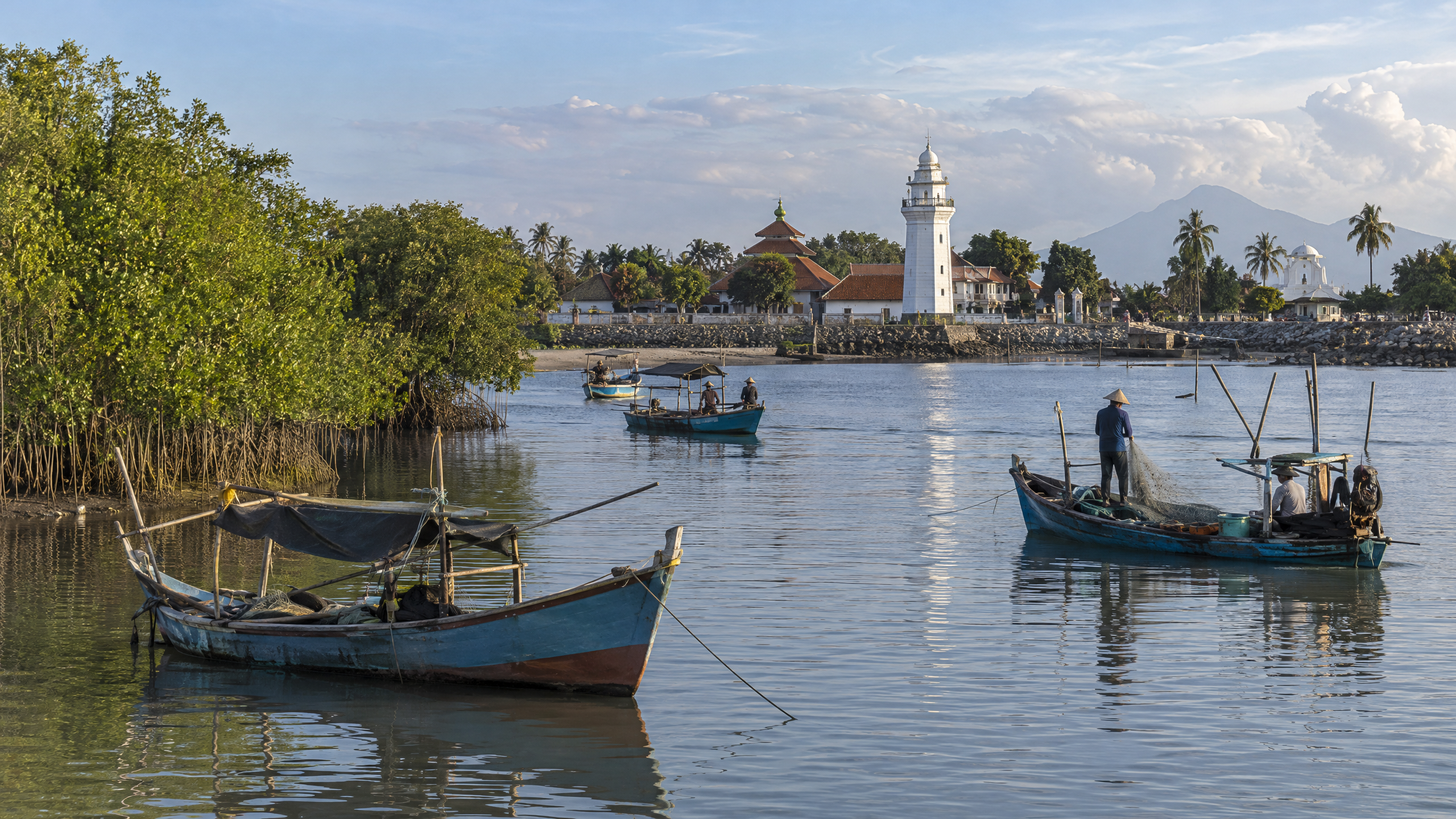
Banten Lama’s port geography is best understood as a connected water-and-landscape system: the Cibanten River reaches the coast at Karangantu, while the surviving monuments sit inland within the former royal city. That relationship helps explain why Banten grew from a river-mouth settlement into a major trading port, and why Karangantu still matters as a working fishing harbour in Kota Serang.
The evidence available by 14 October 2026 does not provide a new, complete map of the historic shoreline or a definitive measurement of how far the old anchorage extended. It does, however, show a consistent pattern: river access, coastal shipping, royal infrastructure and religious landmarks were interdependent.
How are Karangantu, the Cibanten River and Banten Lama connected?
Kecamatan Kasemen’s official profile places the area in northern Kota Serang, with the Java Sea to the north. It identifies the Cibanten as a major river that flows through the district and empties at Karangantu. The same profile places Banten Lama’s cultural heritage area and maritime economy in this wider coastal setting.
A historical site report published by the National University of Singapore describes Banten Lama as being at the mouth of the Cibanten. It records the river’s source as about 30 kilometres inland on Mount Karang, near Mount Pulasari, and distinguishes Banten Lama from Banten Girang, an older settlement farther upstream. The geography therefore linked an inland catchment and agricultural hinterland to a coastal port.
This is more than a matter of modern place names. A river mouth offered a route for people and goods between the interior and the sea, while the coast connected Banten to shipping networks across the Sunda Strait and beyond. The same NUS account says political and commercial power moved downstream from Banten Girang to the coast in the early 16th century, after which Banten Lama expanded rapidly as a Southeast Asian spice-trade centre.
What did Karangantu contribute to the historic port?
Karangantu was the maritime edge of the Banten Lama system. The historical record cited by NUS describes Banten Lama as a pre-eminent port from the 16th through 18th centuries. Its Great Mosque, including a tall minaret, functioned not only as a religious building but also as a landmark visible to ships approaching the anchorage.
That detail matters because it connects a surviving monument to navigation. The mosque was part of the city’s religious and political life, yet its visibility also helped announce the port to people arriving by sea. The port was not an isolated waterfront. It was tied to markets, royal administration, foreign merchant communities and the river corridor leading inland.
Karangantu also remains a working maritime place, although its present role is not identical to the sultanate-era port. The Ministry of Marine Affairs and Fisheries’ Karangantu office reported in January 2026 that the Pelabuhan Perikanan Nusantara Karangantu provided cold-storage services for fishermen, fishery businesses and the public. Its official address is on Jalan Pelelangan Ikan Karangantu, Serang.
Which surviving landmarks help read the old city?
The surviving sites are physical clues to how the port city was organized:
- Masjid Agung Banten remains the clearest religious and navigational marker. The official Indonesia Travel account describes its 16th-century foundation, five-tiered roof and minaret.
- Keraton Surosowan preserves the remains of the sultanate’s governing centre. Its ruins reveal that political power was located close to the commercial world that sustained it.
- Keraton Kaibon retains gates and structural remains associated with the royal family. It shows that the city extended beyond a single palace compound.
- Benteng Speelwijk records the later Dutch military and commercial presence. The official tourism account says the fort also monitored the harbour and trade routes.
- Danau Tasikardi demonstrates that water management was part of the royal landscape. It was an artificial lake associated with the supply of water to the palace area.
- Masjid Pecinan Tinggi and Vihara Avalokitesvara point to the port’s multi-community character and to the presence of Chinese merchants and residents in Banten’s commercial society.
Read together, these landmarks do not form a single surviving waterfront. They form a wider urban record: worship, government, defence, trade, residence and water supply were distributed across a city shaped by access to the river and sea.
What is changing around the river and harbour in 2026?
Flood control and navigation remain practical issues. The Serang city government announced a 2026 plan to normalize Sungai Cibanten, Sungai Karangantu and Kali Padek, with work scheduled to begin in May. The announcement said the Karangantu section would run from the rubber dam toward the estuary for about two kilometres and identified sedimentation as a problem for fishing boats.
A 2026 Antara report on the Cidanau-Ciujung-Cidurian River Basin authority’s work said normalization continued on the Cibanten and that dredging at the Karangantu mouth was intended to remove sediment obstructing fishermen’s access. The reports verify the policy and work focus, but they do not establish that the entire programme was completed by 14 October 2026.
What do we know, and what remains unclear?
What we know: Kasemen’s official profile places the Cibanten’s outlet at Karangantu; the NUS historical report places Banten Lama at the river mouth and links the city to an inland source; government tourism material documents the principal surviving monuments; and the KKP confirms Karangantu’s continuing fisheries function.
What remains unclear: The sources reviewed do not provide a single authoritative 2026 map showing the historic shoreline, the exact limits of the old anchorage, or the precise distance between every monument and the water. They also do not confirm the final physical results of the 2026 normalization works. Those gaps are important: the landscape visible today is a modified river mouth, not a preserved plan of the sultanate-era harbour.
The strongest conclusion is therefore geographical rather than romantic. Banten Lama’s surviving history is legible because Karangantu, the Cibanten and the monuments still point to the same underlying structure: a coastal city whose power depended on moving through water, managing water and making its institutions visible from the sea.
Sources
- https://kasemen.serangkota.go.id/pages/gambaran-umum
- https://epress.nus.edu.sg/sitereports/samis/content/12.%20Banten-an-Early-Islamic-Port/
- https://ppid.kkp.go.id/upt/pelabuhan-perikanan-nusantara-karangantu/news/detail/pelayanan-cold-storage-di-ppn-karangantu-dukung-mutu-hasil-perikanan/
- https://www.indonesia.travel/id/id/travel-ideas/heritage/peninggalan-kerajaan-banten
- https://serangkota.go.id/detailpost/pemkot-serang-siapkan-normalisasi-tiga-sungai-utama-mulai-mei-2026
- https://banten.antaranews.com/berita/387964/pulihkan-daya-tampung-air-bbwsc3-masifkan-normalisasi-sungai-di-serang
- https://dpupr.bantenprov.go.id/berita/mudahnya-akses-ke-kawasan-kesultanan-banten

