
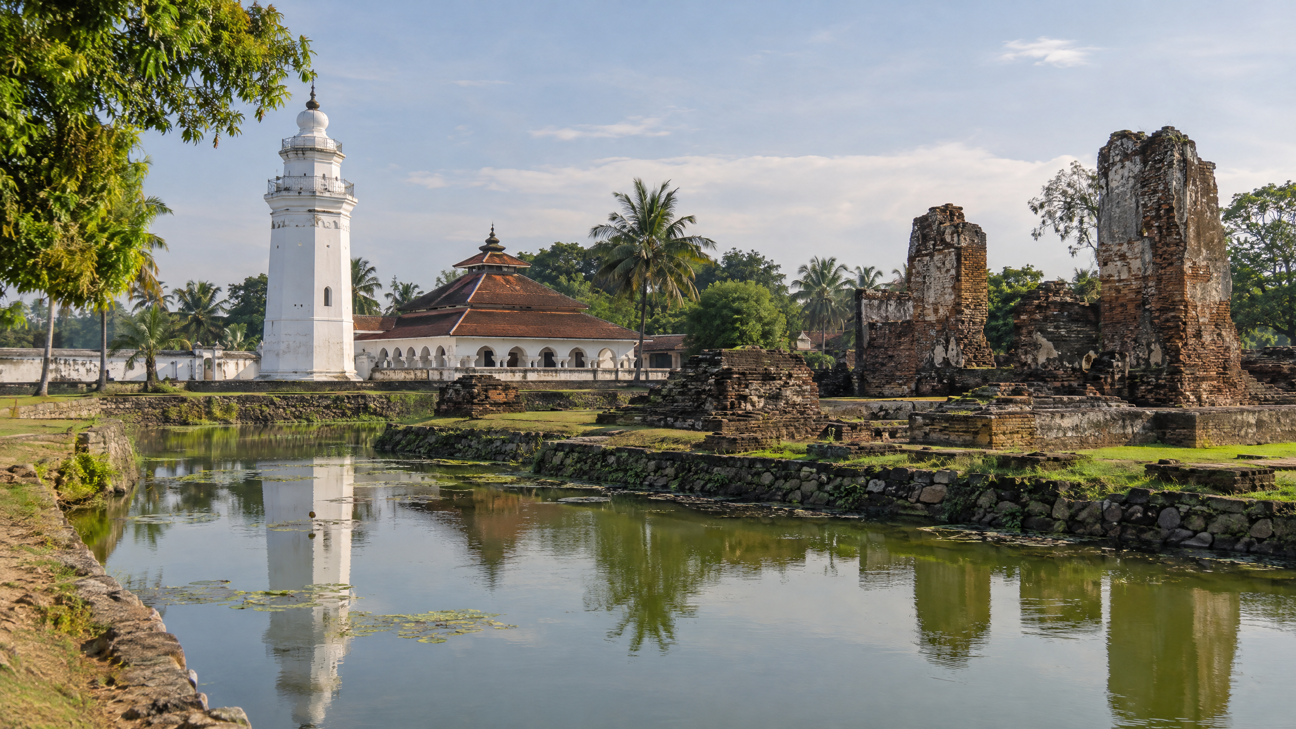
Serang and Banten were not merely neighbouring places on Java’s western edge: together they formed the political, urban and maritime system that connected the island to the Indian Ocean, the Malay world and the Java Sea. Banten Lama was the port, while the wider Serang area supplied the court, markets, waterways and hinterland that made long-distance exchange possible.
This distinction matters today because “Serang” can mean the modern city or the wider historical region, whereas the port described in early sources was Banten Lama, now in Kasemen, within Serang City. The record available by 14 October 2026 supports a powerful historical role, but it does not provide a new October 2026 measure of trade volume; this article therefore separates documented history from present-day assumptions.
What is the short answer about Serang and Banten’s trade role?
Banten’s seaport was the gateway and marketplace. Serang’s surrounding political centre and inland connections helped sustain it. After Portugal seized Melaka in 1511, a scholarly account from the National University of Singapore says many Muslim merchants moved to Banten, which became a new centre of Southeast Asian trade. By the sixteenth through eighteenth centuries, Banten Lama had grown into a major hub for spices traded with Asia and Europe.
Why did Banten Lama become a western Java trading hub?
Geography gave Banten an unusual advantage. The port stood at the western end of Java, close to the Sunda Strait, where shipping could move between the Java Sea, Sumatra and routes toward the Indian Ocean. The NUS archaeological report places the city at the western mouth of the Cibanten River and describes a port organised around customs, storage, markets and separate quarters for foreign communities.
Pepper was one of the commodities that made Banten wealthy. The report identifies Pamerican as a place where pepper was stored, while Pabean was associated with the collection of port duties. At Karangantu, outside the city wall near the eastern mouth of the river, a major market served foreign Muslim communities. The report says this was the largest of three markets in Banten.
Those details show that trade was not only about ships anchoring offshore. It required taxation, warehouses, moneylenders, brokers, market rules and residents who could translate between commercial worlds. Merchants came from Java, Sumatra, Borneo, Sumbawa, Makassar, Banda and Ambon, alongside traders from South India, Gujarat, Bengal, Burma, Thailand, Arabia, Persia and China. This was a multi-directional network, not a one-way export lane.
How did Serang support the port?
The modern city of Serang grew around the political history of the Banten Sultanate. The Serang Regency government’s historical account places the earlier centre at Banten Girang, about three kilometres south of present-day Serang, before the government moved to Surosowan in Banten Lama, roughly ten kilometres to the north. That shift brought court power closer to the coast and the port.
The official City of Serang history describes the area as a centre of government, maritime commerce and culture, and identifies Surosowan, Tasikardi, Speelwijk and Banten Lama as surviving markers of that past. These sites should not be treated as proof that every modern street follows an old trading road. They do, however, help explain the relationship between palace, water management, defence and commerce in the historic landscape.
Which political changes reshaped the route?
Banten’s rise followed a wider transformation in Asian maritime commerce. The NUS account says Banten and Sunda Kalapa were under Muslim rulers by 1526, and that Islam, foreign merchant communities and European arrivals altered the balance between coastal and inland power. Banten’s rulers could use the port’s position to welcome, regulate or negotiate with distant traders.
The seventeenth century brought both commercial strength and sharper competition. The Banten provincial government identifies the era of Sultan Ageng Tirtayasa as a high point and describes Banten as an international port. Britannica records that the sultan encouraged English and French trade while resisting Dutch expansion early in his rule; after an internal succession conflict, Dutch influence increased and a trade monopoly was granted. That change illustrates how control of commerce was also a contest over sovereignty.
What do “Banten Lama,” “Karangantu” and “Serang” mean here?
- Banten Lama means “Old Banten,” the historic city and port area associated with the Sultanate.
- Karangantu was a port and major market area outside the walled city, near the Cibanten river mouth.
- Serang refers here both to the historical region around the Sultanate’s centres and to the modern administrative city that contains Banten Lama in Kasemen.
- Western Java trade routes means the connected sea, river and land links that joined Banten with Sumatra, other Indonesian islands, Asian markets and European shipping, rather than one fixed highway.
Which facts are verified, and what remains unclear?
What we know: official Banten and Serang government pages place key Sultanate remains in today’s Serang area; the official provincial tourism account identifies Karangantu’s role in Banten’s prosperity; and the NUS archaeological synthesis documents the port’s markets, pepper storage, customs function and cosmopolitan merchant population. The provincial government also reported in March 2026 that it planned to continue revitalising Sultanate sites, while describing Banten’s historical links with India, Arabia, China and the archipelago.
What remains unclear: the sources used here do not establish a precise annual tonnage for all Banten trade, a complete map of every inland route, or an October 2026 measure of Karangantu’s current commercial activity. They also reflect different purposes: government pages preserve local historical narratives, while the NUS report synthesises archaeology and historical research. Readers should therefore treat broad claims about Banten’s importance as well-supported, but avoid turning them into unsupported rankings or exact modern comparisons.
Serang and Banten’s historical importance rests on this combination: a strategically placed port, an administratively capable sultanate, and a hinterland able to connect coastal commerce with the rest of Java. The surviving ruins are not the trade route itself, but they are the physical record of the institutions that made western Java a meeting point in early modern Asia.
Sources
- https://bantenprov.go.id/sejarah-banten
- https://serangkota.go.id/pages/sejarah-kota-serang
- https://serangkab.go.id/sejarah
- https://dispar.bantenprov.go.id/berita/mengenal-sejarah-banten-di-museum-situs-kepurbakalaan-di-kawasan-kesultanan-banten
- https://bantenprov.go.id/index.php/berita/revitalisasi-situs-kesultanan-banten-akan-dilanjutkan-pemprov-bidik-lonjakan-wisata-sejarah-dan-religi
- https://epress.nus.edu.sg/sitereports/samis/content/12.%20Banten-an-Early-Islamic-Port/
- https://www.britannica.com/place/Banten-former-sultanate-Indonesia

