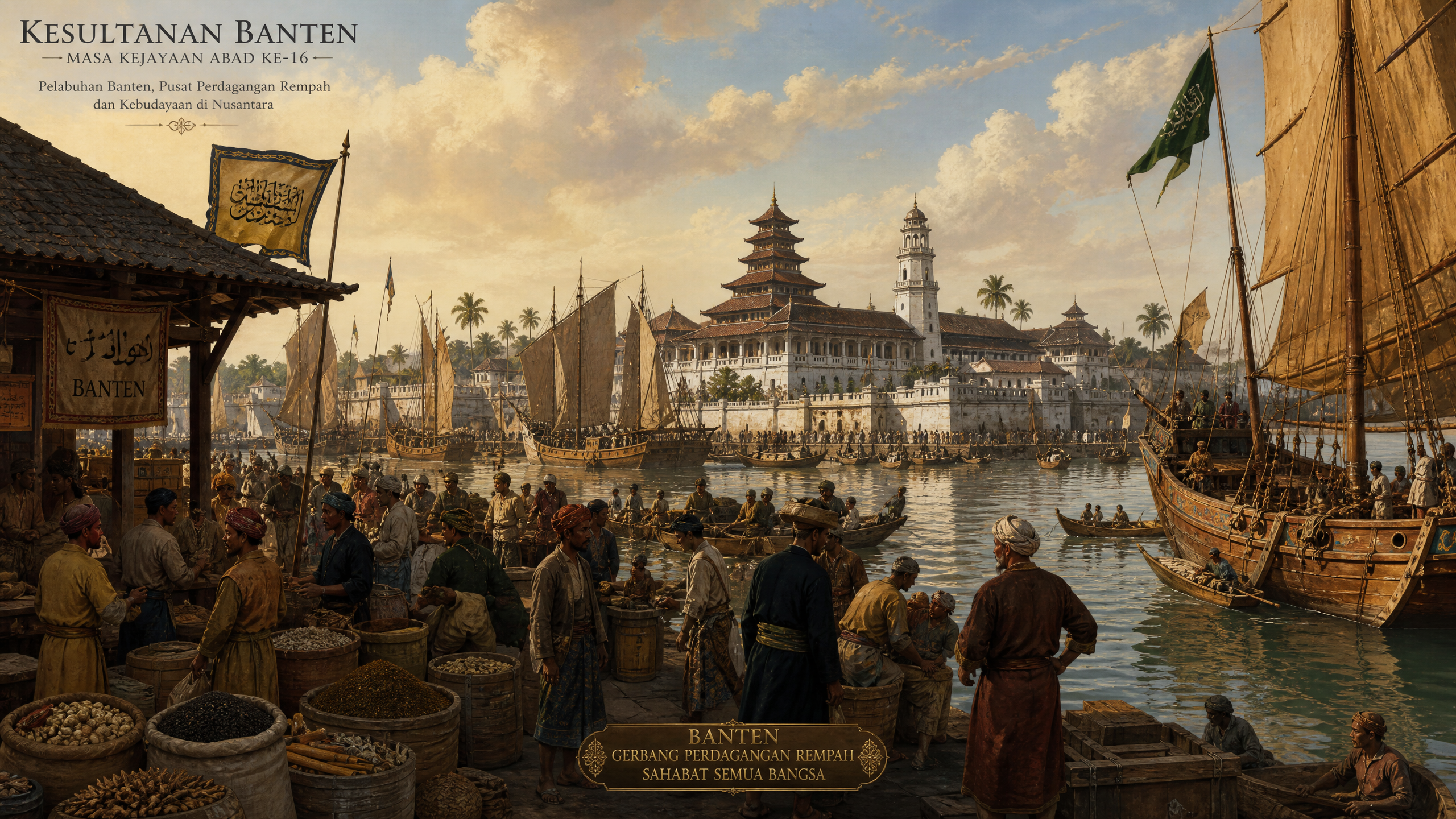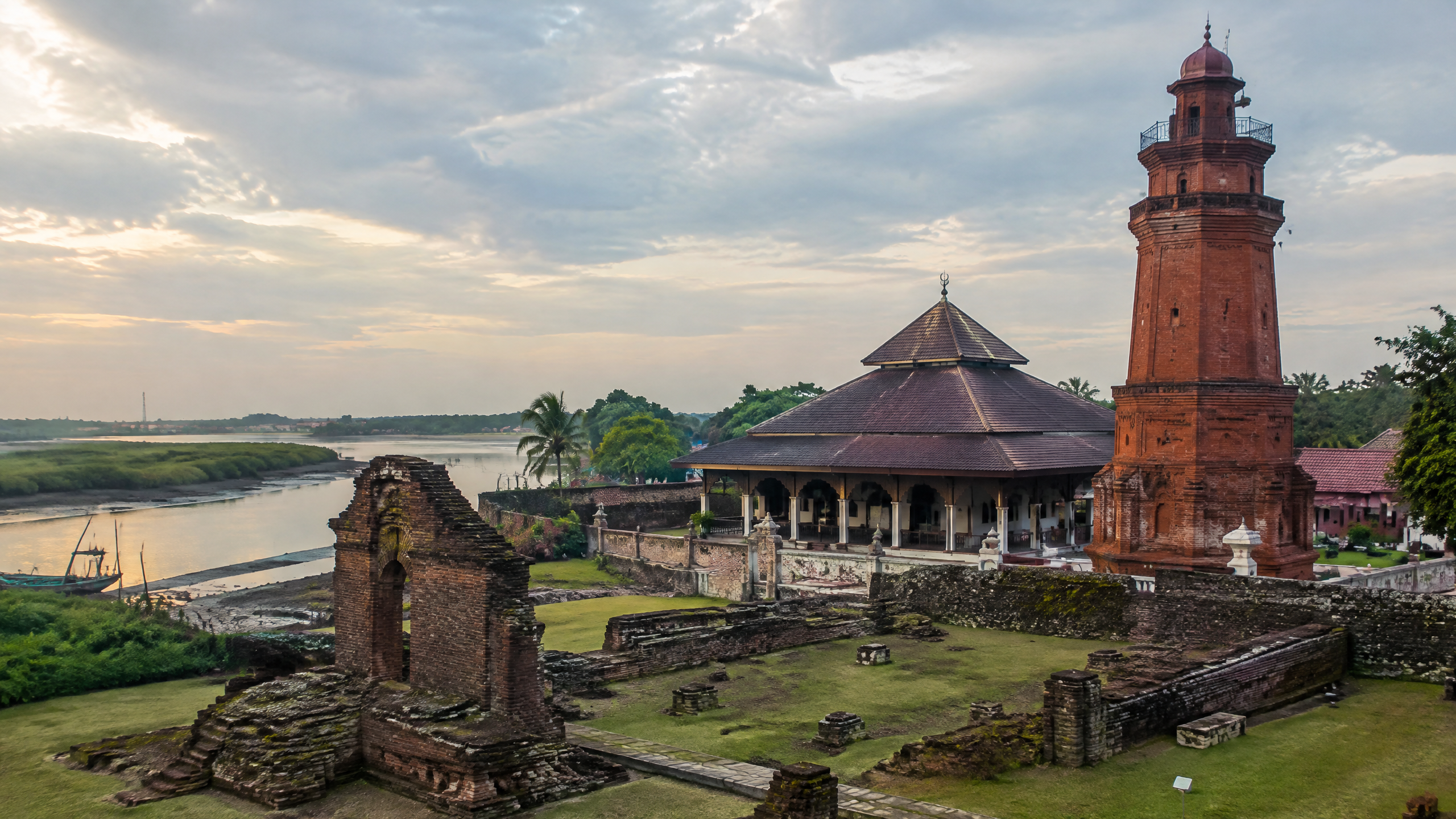
At Banten Lama in Kasemen, Serang, architecture records more than royal power: it records movement. The Sultanate of Banten grew into an international port where merchants from the Indonesian archipelago, South Asia, China, the Middle East and Europe met, traded and sometimes settled. Its surviving palace walls, mosque precinct, market zones and named kampungs therefore read as a physical map of cultural exchange, even though the ruins cannot answer every question about how people lived.
The evidence does not support a simple story of one foreign style replacing a local one. Instead, Banten’s built environment combined an inherited Javanese urban pattern with Islamic institutions, port logistics and spaces organised for different communities and occupations. The clearest reading is a negotiated city: local rulers controlled the political and religious core while trade and migration made the surrounding urban landscape more diverse.
What did Banten Lama’s architecture reveal about trade?
The provincial government identifies the remains of Keraton Surosowan, the Great Mosque of Banten and archaeological artefacts as the principal physical witnesses in Banten Lama, now part of Serang City. It also describes Banten’s historical peak under Sultan Ageng Tirtayasa (1631–1692) and its role as an international port and trading centre. A 2026 provincial account frames the old capital through three linked functions: Surosowan as political authority, the Great Mosque as spiritual authority and Karangantu as the economic sphere.
Archaeological research adds detail to that relationship. A study published by the National University of Singapore’s e-PRESS describes a central walled zone containing the palace, royal mosque, public square and indigenous residential enclaves. To the west were Chinese and, later, European areas; foreign Muslim communities occupied the east. At the Cibanten’s western mouth, customs activity and pepper storage were associated with Pabean and Pamarican. Karangantu, outside the eastern wall, hosted a major market and foreign Muslim residents.
This was not merely a diagram of buildings. It was infrastructure for exchange. Banten’s river and canals connected the settlement to boats, while markets linked port duties, storage, credit and retail distribution. Pepper was a major commodity, and imported ceramics found at Banten are evidence of long-distance connections. The separation of commercial functions around waterways and gates shows how architecture supported the movement of goods as well as people.
How did migration change the city’s social geography?
The port drew merchants from Java, Sumatra, Borneo, Sumbawa, Makassar, Banda and Ambon, alongside people identified in historical accounts as South Indians, Gujaratis, Bengalis, Burmese, Arabs and Persians. The NUS report also records an Ethiopian presence. Some foreigners were transient traders; others lived in designated quarters. That distinction matters: a place-name or quarter demonstrates an organised urban presence, but it does not automatically prove a permanent, uniform ethnic population.
Research on Banten’s settlement structure identifies toponyms associated with Chinese, Balinese, Indian, Bugis and other groups, as well as places named for embroidery, bamboo work, net-making, metalwork, pottery and pepper storage. These names suggest that migration and production were spatially connected. They also show that cultural exchange was practical. Skills, languages, religious institutions and commercial relationships met in the same urban system.
Islam shaped the political identity of the sultanate, but the city was not architecturally isolated. The Great Mosque’s tall minaret is described by the NUS study as an Indo-Islamic feature visible from the sea and useful as a landmark for approaching ships. The same source cautions against treating the city plan as uniquely Islamic: its layout, markets, water management and occupational quarters also resemble older Javanese urban traditions. Cultural exchange is therefore visible in adaptation, not in a single signature style.
What does Surosowan show about local and foreign building knowledge?
The Atlas of Mutual Heritage records that the first Surosowan kraton was constructed during the reign of Sultan Maulana Hasanuddin (1552–1570). His successor, Sultan Maulana Yusuf (1570–1580), built an enclosing wall of brick and coral stone. After fires in 1605 and 1607, the palace was rebuilt. Later fortification work brought Dutch masonry knowledge into the royal compound: Hendrik Lucasz Cardeel, a Dutch stone-mason who converted to Islam and took the name Pangeran Wira Goena, built a new fortified wall in 1680–1681.
That sequence is a useful warning against calling every European element colonial imposition from the beginning. Foreign expertise entered a court shaped by local political decisions, while the VOC’s military involvement later altered the balance of power. The same heritage account says the Dutch built Fort Speelwijk to strengthen their influence after intervention in Banten’s civil war. Architecture here was both exchange and coercion.
What do we know, and what remains unclear?
What we know:
- Banten Lama was a major international port and political centre, with surviving evidence at Surosowan, the Great Mosque, Karangantu and related archaeological sites.
- Historical and archaeological accounts describe organised quarters for foreign communities and occupational groups, alongside markets, customs activity, pepper storage and waterways.
- Building practices combined brick and coral construction, Islamic religious architecture, inherited Javanese planning traditions and later Dutch fortification work.
- Trade and migration were not background events; they helped determine where people lived, worked, worshipped and moved.
What remains unclear: the surviving record cannot provide a complete census of each community, a precise map of every vanished structure or a simple measure of how much cultural exchange occurred inside individual buildings. Published population estimates also belong to particular historical moments and should not be treated as continuous data. As of the 14 October 2026 working date, no complete official October 2026 assessment was located that revises these historical interpretations; this article therefore relies on the latest accessible institutional and scholarly materials listed below.
Definition: “Cultural exchange” here means the movement and adaptation of people, skills, religious practices, commodities and building knowledge across communities. It does not mean that all groups had equal power or that cultural boundaries disappeared.
Sources
- https://bantenprov.go.id/sejarah-banten
- https://bantenprov.go.id/berita/revitalisasi-situs-kesultanan-banten-akan-dilanjutkan-pemprov-bidik-lonjakan-wisata-sejarah-dan-religi
- https://epress.nus.edu.sg/sitereports/samis/content/12.%20Banten-an-Early-Islamic-Port/
- https://www.atlasofmutualheritage.nl/page/6991/surosowan-fort
- https://www.researchgate.net/publication/361371590_Cosmopolitanism_of_the_Sultanate_of_Banten_An_Overview_of_Settlement_and_Social_Structure_of_the_15th_Century