
Anyer and Carita visitors should treat 14 October 2026 as a check-before-you-go day: verify the latest Badan Geologi/PVMBG volcano notice, follow local BPBD and beach-guard instructions, and check BMKG weather and marine forecasts before swimming or boarding a boat. The latest dated official ESDM release directly verified for this article lowered Anak Krakatau from Level III (Siaga) to Level II (Waspada) on 21 September 2026, but it kept a 2-kilometre exclusion zone around the active centre. That does not make a trip to the volcano permissible, and it does not replace a route-specific marine safety decision.
What is the short safety answer for Anyer and Carita?
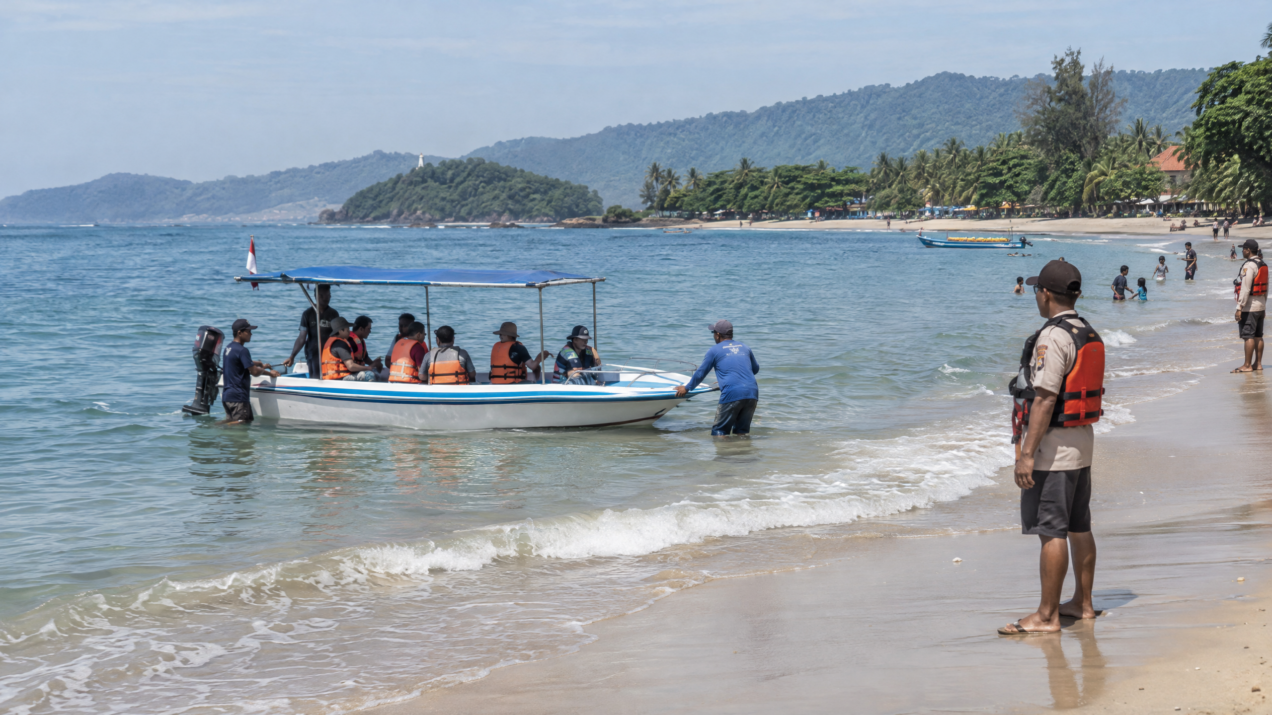
Beach visits can proceed only where the operator or local authority has not closed the area and conditions are suitable. Stay on marked public areas, obey lifeguards, leave the water when warnings or rough conditions appear, and do not charter a boat toward Anak Krakatau or enter its exclusion zone. For any boat trip, confirm the departure decision with the operator on the same day, check the vessel’s safety equipment and passenger limit, wear a life jacket from boarding to disembarkation, and cancel if the master, harbour authority or weather service says conditions are unsuitable.
What should beach visitors check before swimming?
- Check the authority notice first. Ask the beach manager or Balawista about swimming boundaries, rip-current warnings, closures and the nearest first-aid or evacuation point. The Banten provincial government has previously stressed coordination among local government, BPBD, Balawista and tourism operators, and has directed visitors to use BMKG information as the weather reference.
- Use the designated swimming area. Do not cross boat lanes, breakwaters or temporary barriers. Never swim alone, and keep children within arm’s reach in moving water.
- Read the sky and water, not just the beach. Rain, reduced visibility, sudden wind, a strong current or a fast change in wave conditions is a reason to leave the water and ask staff whether activities are suspended.
- Prepare for ash if an official notice reports it. BNPB’s September update advised people exposed to volcanic ash to reduce outdoor activity, use a mask and eye protection, cover food and water, and avoid spreading unverified reports. Carry a mask, especially if travelling with children or people with respiratory problems.
- Keep an exit plan. Save local emergency contacts, identify the road out and tell someone where your group is staying. Do not wait for a crowd to move before following an official instruction.
What should passengers check before a boat trip?
- Check the route, not only the destination. Ask whether the trip stays in ordinary coastal tourism waters or approaches the volcano. A sightseeing boat must not enter the exclusion zone, and a clear view of Anak Krakatau is not permission to land, anchor or approach the active centre.
- Inspect basic safety arrangements. Every passenger should receive a correctly sized life jacket and a safety briefing. Ask about the passenger manifest, maximum capacity, communications, fuel, weather cancellation policy and the return plan. Do not board an overloaded, visibly damaged or poorly equipped boat.
- Use the latest marine forecast. BMKG’s 13 October forecasts for the Carita and Anyer port points showed changing wind and cloud conditions. The west Pandeglang waters forecast also recorded gusts in the mid-20-knot range on 13 October, alongside rain or reduced visibility at times. A calm-looking beach does not prove that the open route is safe.
- Postpone for deterioration. Do not depart during lightning, heavy rain, poor visibility, rising wind or a local warning. The boat master and harbour or port authority have the final operational call; passengers should not pressure them to sail.
- Keep the phone dry and accessible. Share the boat name, departure point, passenger count and expected return with a contact ashore. If a trip is delayed, remain with the operator and follow Basarnas, BPBD or harbour instructions rather than launching an independent search.
What do Level II and the exclusion zone mean?
Level II (Waspada) is an Indonesian volcanic-alert status indicating that activity requires increased caution and monitoring; it is not a tourism clearance. In its 21 September release, ESDM said visitors and the public must not enter or conduct activities within 2 km of Anak Krakatau’s activity centre and must remain alert to incandescent-rock falls and heavy ash. The official September 10 evaluation, issued while the volcano was still Level III, described continuing volcanic dynamics and said the probability of further eruptions remained high. Alert levels and distances can change, so use the newest notice rather than an old screenshot.
What do we know, and what remains unclear on 14 October 2026?
What we know: Badan Geologi lowered the status from Level III to Level II effective 21 September 2026 after activity declined, while retaining the 2-km restriction. Reuters reported on 3 October that the eruptions had enlarged the volcano by 32.8 hectares and that satellite imagery showed two nearby new land formations; the agency said more data and analysis were needed to determine whether they were new eruption centres. BMKG’s local forecasts show why a same-day marine check matters: conditions vary by port and by open water.
What remains unclear: The official materials directly verified for this article do not establish a new, route-specific October 14 closure for every Anyer or Carita beach, nor do they provide a blanket approval for all boat operators. They also do not support assuming that conditions at an Anyer or Carita port represent the waters near the volcano. Visitors should therefore verify the current notice through PVMBG/Badan Geologi, MAGMA Indonesia, BMKG and the local BPBD before departure. If those sources, the harbour authority or beach safety staff give different instructions from a tour seller, follow the official safety instruction and do not sail.
Where can visitors verify the latest information?
Use BMKG’s local and marine forecast pages for Carita, Anyer and west Pandeglang waters; use Badan Geologi or MAGMA Indonesia for the volcano status and exclusion zone; and check BPBD, Basarnas, the harbour authority and the beach manager for local closures, rescue readiness and operating decisions. Information can change faster than a travel itinerary. A postponed swim or boat trip is a normal safety decision, not a failed holiday.
Sources
- https://www.esdm.go.id/id/media-center/arsip-berita/aktivitas-anak-krakatau-menurun-badan-geologi-turunkan-status-dari-siaga-menjadi-waspada
- https://geologi.esdm.go.id/media-center/perkembangan-erupsi-gunungapi-anak-krakatau-tanggal-10-september-2026
- https://www.bnpb.go.id/berita/update-aktivitas-gunung-anak-krakatau-berlanjut-empat-bandara-ditutup-sementara-akibat-sebaran-abu-vulkanik
- https://maritim.bmkg.go.id/cuaca/pelabuhan/pelabuhan-anyer
- https://maritim.bmkg.go.id/cuaca/pelabuhan/pelabuhan-carita
- https://maritim.bmkg.go.id/cuaca/perairan/selat-sunda-barat-pandeglang
- https://www.bmkg.go.id/cuaca/prakiraan-cuaca/36.01.28.2002
- https://bantenprov.go.id/berita/pastikan-keamanan-jelang-nataru-gubernur-banten-andra-soni-tinjau-kesiapan-wisata-anyer-dan-carita
- https://www.reuters.com/business/environment/indonesia-detects-new-land-formations-anak-krakatau-eruptions-2026-10-03/


